
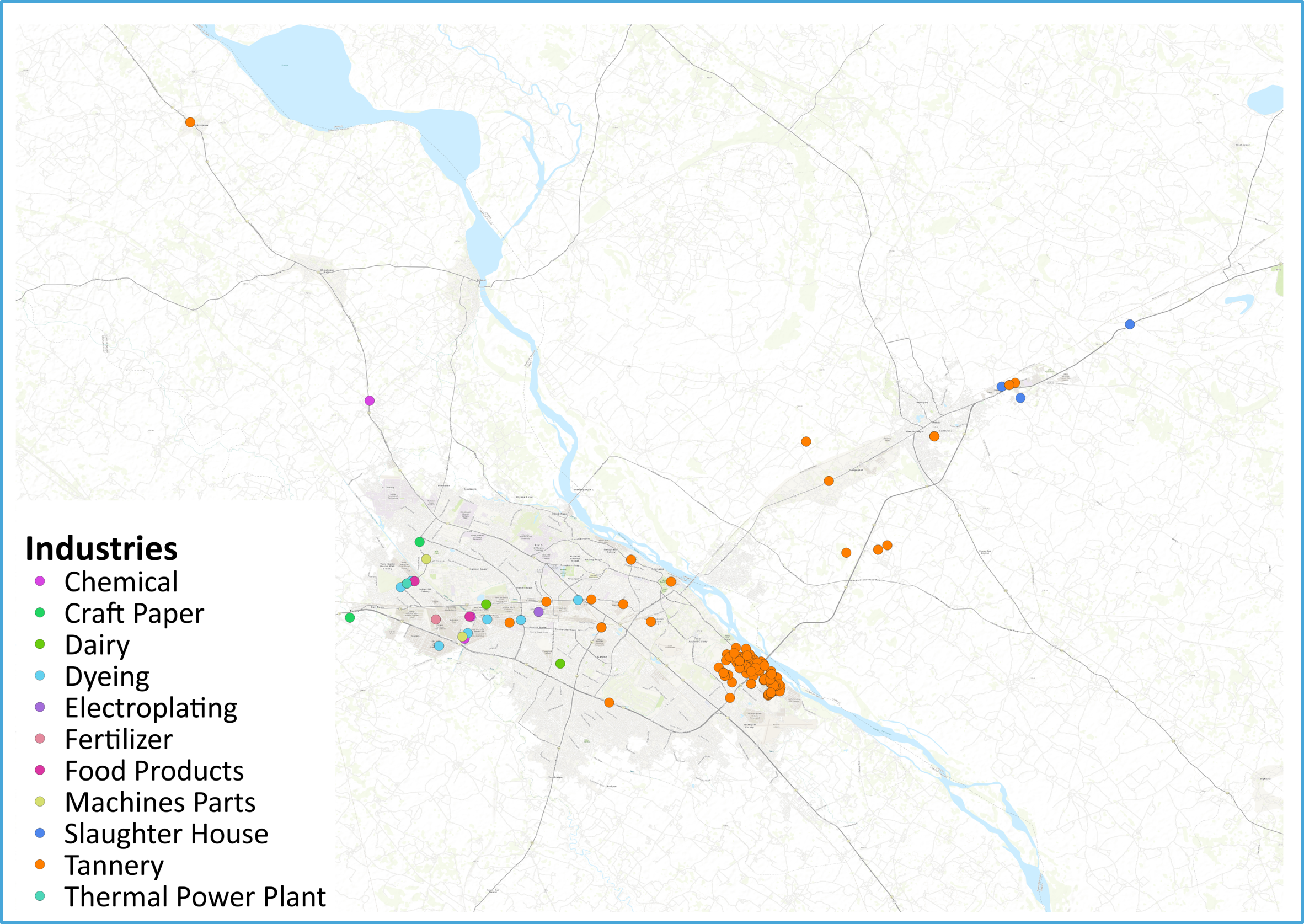
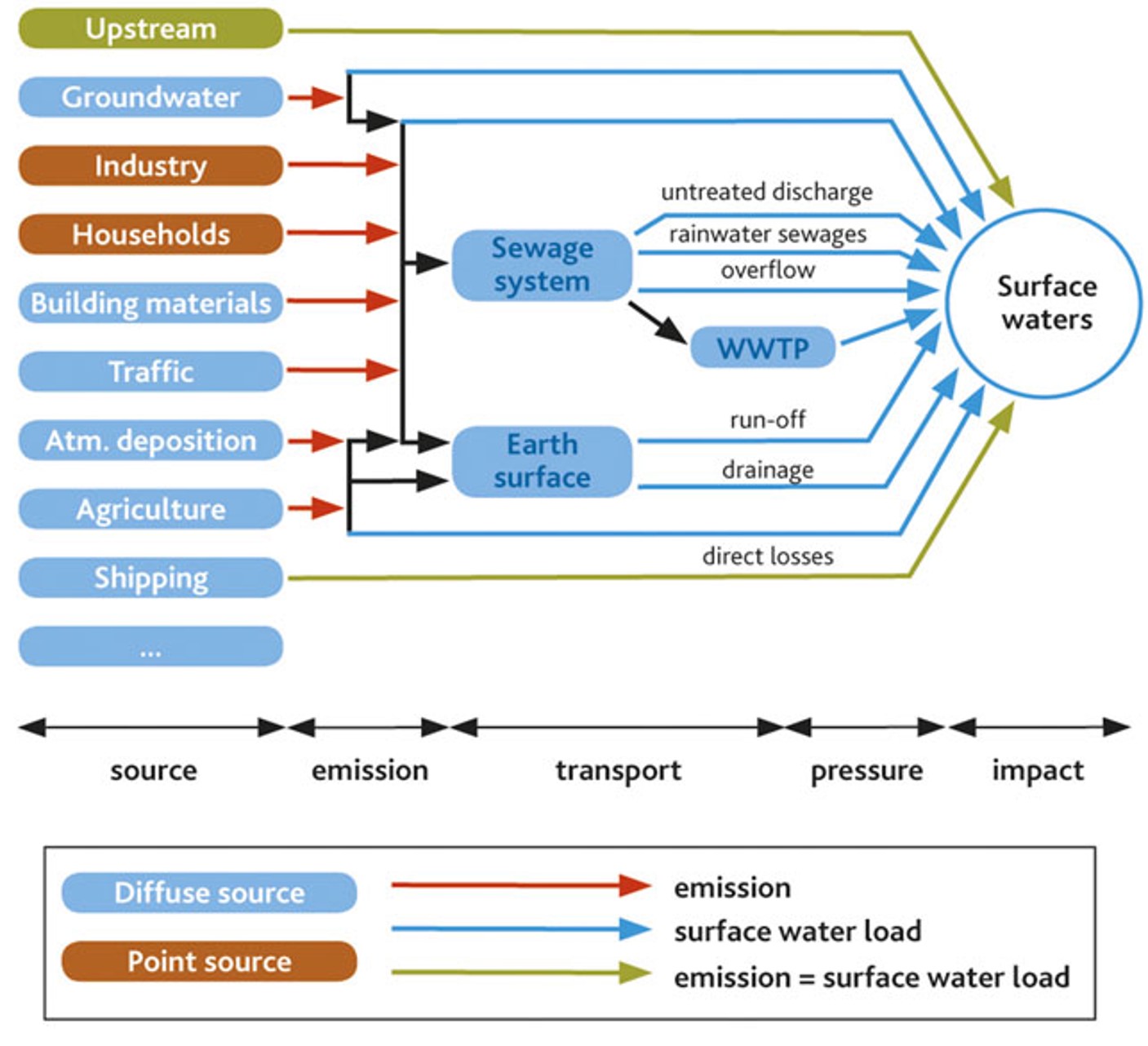
Improved land use maps are used as a source for VITO’s Water Emissions Inventory Support System (WEISS) model, which maps relevant pollution caused by major emission sources and their pathways to water bodies. The approach allows us to better understand and identify the sources of pollution for the case study catchments, and will used for developing the urban nodes of the regional WEAP modelling baseline and scenarios.
Involved Partners

